Mark Dominus (陶敏修)
mjd@pobox.com

Archive:
| 2026: | JFM |
| 2025: | JFMAMJ |
| JASOND | |
| 2024: | JFMAMJ |
| JASOND | |
| 2023: | JFMAMJ |
| JASOND | |
| 2022: | JFMAMJ |
| JASOND | |
| 2021: | JFMAMJ |
| JASOND | |
| 2020: | JFMAMJ |
| JASOND | |
| 2019: | JFMAMJ |
| JASOND | |
| 2018: | JFMAMJ |
| JASOND | |
| 2017: | JFMAMJ |
| JASOND | |
| 2016: | JFMAMJ |
| JASOND | |
| 2015: | JFMAMJ |
| JASOND | |
| 2014: | JFMAMJ |
| JASOND | |
| 2013: | JFMAMJ |
| JASOND | |
| 2012: | JFMAMJ |
| JASOND | |
| 2011: | JFMAMJ |
| JASOND | |
| 2010: | JFMAMJ |
| JASOND | |
| 2009: | JFMAMJ |
| JASOND | |
| 2008: | JFMAMJ |
| JASOND | |
| 2007: | JFMAMJ |
| JASOND | |
| 2006: | JFMAMJ |
| JASOND | |
| 2005: | OND |
Subtopics:
| Mathematics | 246 |
| Programming | 100 |
| Language | 95 |
| Miscellaneous | 75 |
| Book | 50 |
| Tech | 49 |
| Etymology | 36 |
| Haskell | 33 |
| Oops | 30 |
| Unix | 27 |
| Cosmic Call | 25 |
| Math SE | 25 |
| Law | 23 |
| Physics | 21 |
| Perl | 17 |
| Biology | 16 |
| Brain | 15 |
| Calendar | 15 |
| Food | 15 |


Comments disabled
Fri, 01 Oct 2021
Ida-related flooding in Philadelphia
On September 1, Hurricane Ida hit Pennsylvania. Several tornadoes touched down near where I live in Philadelphia, and five people were killed. Fortunately Philadelphia itself was spared, and from where I live it only appeared to be an unusually-heavy rainstorm.
But Philadelphia is on the Schuylkill River, and all the water that Ida dumped northwest of Philadelphia ended up in the Schuylkill, which flooded epically and historically.
I-95 and I-76 also run through Philadelphia, and connecting them, in a deep trench along the northern boundary of the business district, is the Vine Street Expressway. Normally it looks like this:
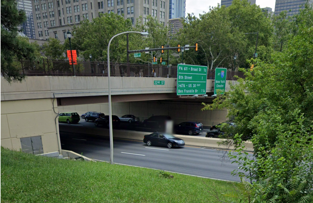
(Google Street View, July 2019)
But on September 1 it looked like this:

Holy cow. I'd never seen anything like this before. How long would the expressway be shut down? I had no idea.
Toph and I went up there on September 4 to see the damage, but by then there wasn't much to see. It looked like this:
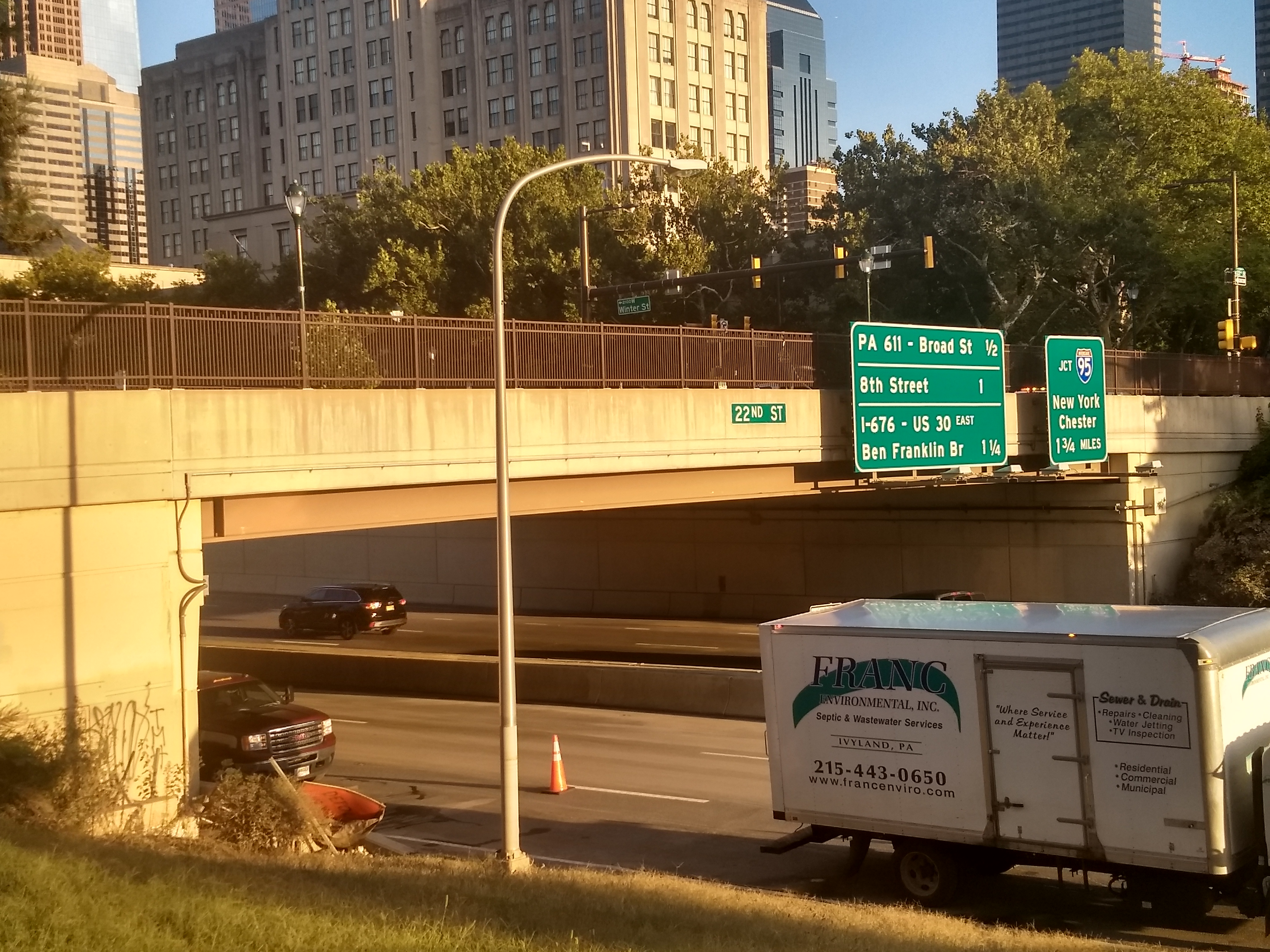
Traffic was flowing normally in the eastbound lane (far side). The westbound lane (near side, with the cone) was still closed but it was obvious that they were finishing the cleanup. That's some amazing work. I have no idea how you even begin to get something like that cleaned up, and no idea how to get it done in three days.
The streets were a little dirtier than usual, but if I hadn't known to look I probably wouldn't have noticed. (Philadelphia.) We did pass houses that had piles of ruined books outside, and we encountered two gentlemen who were glumly carrying out loads of soggy carpet from their flooded basement.
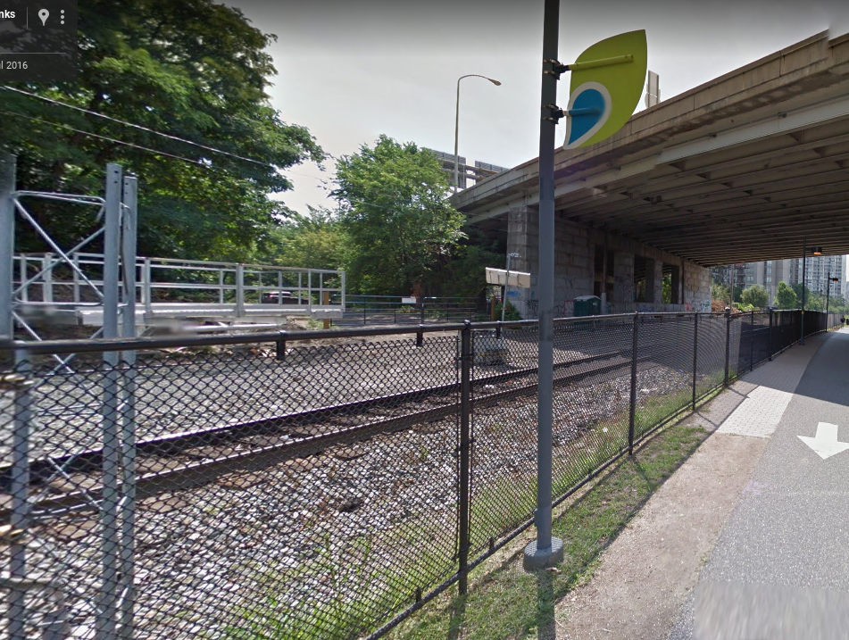
We walked on the path that runs by the river, which is normally about two or three meters above the level of the river itself. The river didn't look higher than usual, but we did see signs of the flood. The path is between the river and the train tracks, and there is a fence to keep you from crossing the tracks.
Here's picture I took on September 4:
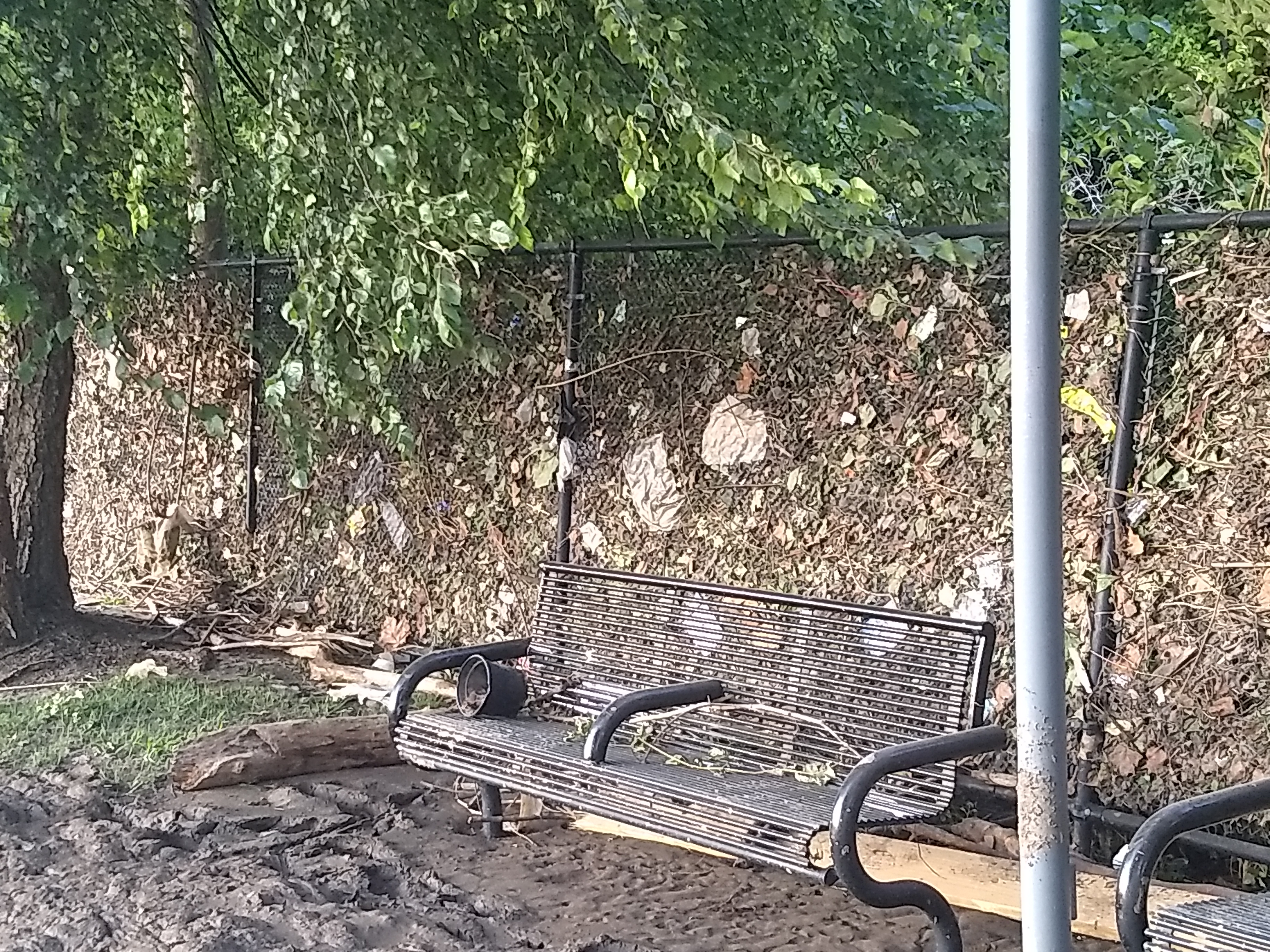
The river has piled driftwood and other trash at the base of the fence. The fence itself is clogged with leaves and paper, left there when the river poured through it as through a sieve. The river not only overtopped its banks and flooded the footpath, it must have reached at least to the top of the fence.
Here's another shot of the fence. Over here the sieve became too clogged to let the water through and the entire fence collapsed. The on-ramp for the expressway is visible in the background.
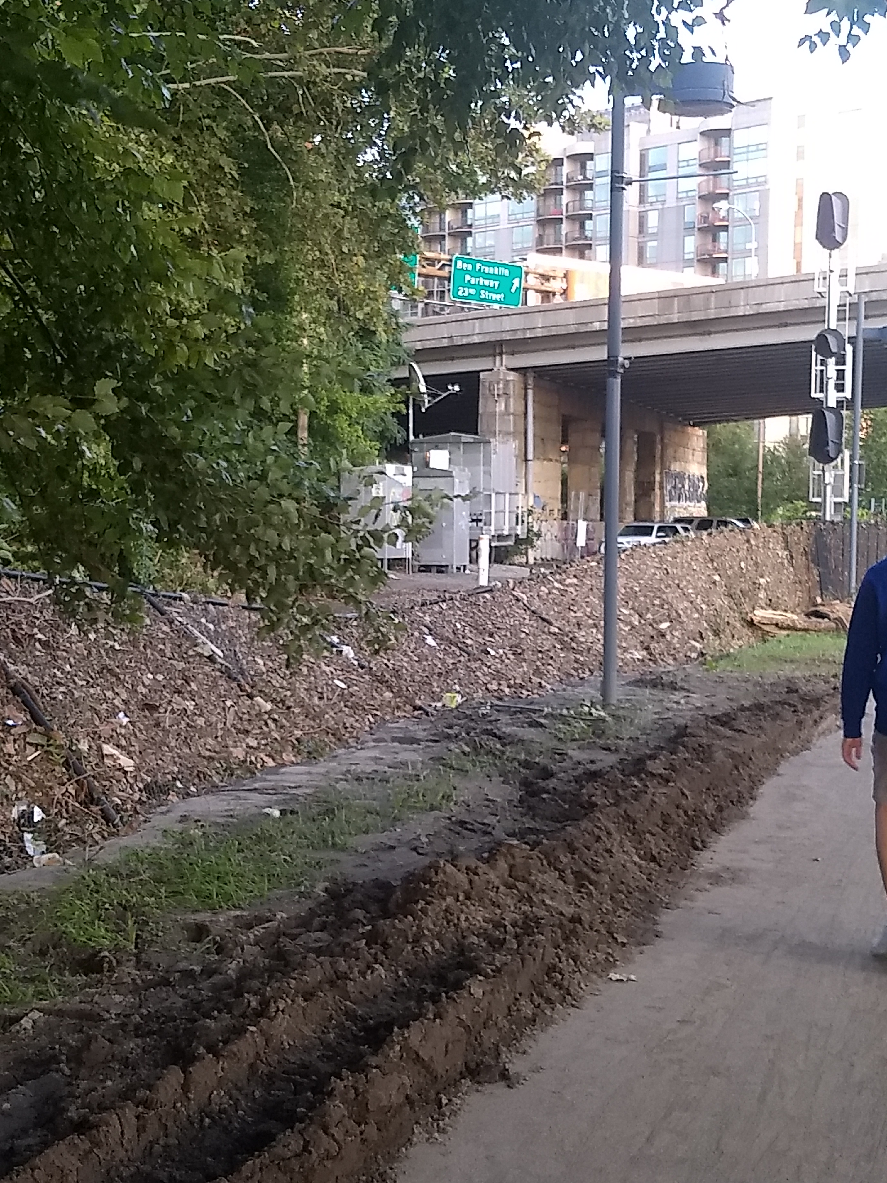
Here's Google's Street View picture of what the fence was like in July 2016:
I have no special point to make, and leave you with this, which I think should be part of the Philadelphia historical archives. Content warning: unsanitary behavior.
[Other articles in category /misc] permanent link